
 BY
BY Table of Contents
Leave the microstates and Malta aside and the Netherlands is the most densely populated country in Europe, at roughly 520 people per square kilometer. And yet when you’re in a Dutch city, it doesn’t feel that way.
The biggest reason is that not everybody is in a car. People get around by bike, on foot, and by tram and train, and none of those take up much room.

The smaller reasons are the interesting part, because they compound, and because none of them are accidents. They trace back to two words that English quietly collapsed into one.
Two Words the English Language Collapsed Into One
A road connects productive places. Its job is throughput: Move people and freight between destinations at speed, with tightly limited access. A highway is a road.
A road is a pipe.
A street is a platform for building wealth. Its job is exchange: Shops, homes, workshops, and people encountering each other at low speed and high complexity.
A street is a place.
These are opposite engineering problems. Speed on a road is the entire point. Speed on a street destroys the thing the street exists to do, because wealth on a street is generated by people outside their cars, and people outside their cars rarely survive contact with traffic moving at 45 miles an hour.
Most of the American built environment does neither job. Chuck Marohn, a civil engineer who spent his early career designing the thing he now spends his life attacking, named the hybrid in 2011: The stroad. Five lanes, a 45 mph design speed, and a curb cut every hundred feet into a parking lot.
Marohn calls it the futon of transportation, an uncomfortable couch that doubles as an uncomfortable bed. It moves traffic badly, because every driveway is a conflict point. It builds wealth badly, because almost nobody walks. And it costs more per mile to build and maintain than either of the two things it fails to be.
(The term is Marohn’s, not Not Just Bikes’. Jason Slaughter’s channel is where most people, myself included, first met the idea, and he credits Strong Towns for it.)
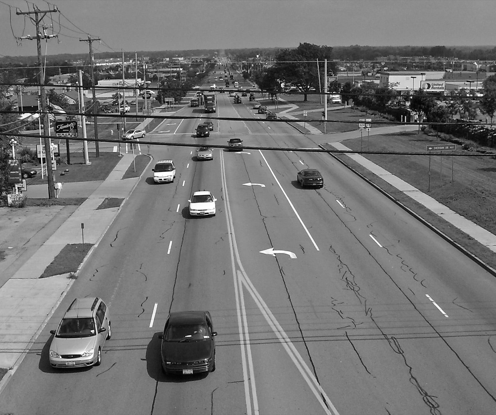
Photo: Daniel Case, Wikimedia Commons, CC BY-SA 3.0

The Dutch did not merely keep the two words apart. They wrote down a third one and put numbers on all of it.
Since the 1990s, under a national road safety program called Duurzaam Veilig, Sustainable Safety, every road in the Netherlands is sorted into one of three categories. A stroomweg is a through road, built to carry traffic between places and nothing else. A gebiedsontsluitingsweg is a distributor road, connecting places inside a city, carrying signals or roundabouts, and carrying no driveways to destinations, because a driveway on a through-road trades away the safety and efficiency the road exists to provide. An erftoegangsweg is a neighborhood access street, and the national guideline caps it by volume at roughly 5,000 to 6,000 motor vehicles per day.
The hierarchy is enforced too. An access street cannot connect directly to a through road; it has to reach one via a distributor.
The cap is the part that matters. If a street exceeds it, the street gets redesigned until it does not.
Which is why multi-lane stroads lined with driveways and side streets effectively do not exist in the Netherlands. Not because the Dutch have better taste. Because a category forbids them and a number enforces it.
The same grammar runs the intersections. Stop signs are rare in the Netherlands; the default rule is yield to the driver on your right, and where the default doesn’t apply, a painted row of small white triangles, haaientanden, shark’s teeth, tells you exactly where to give way. Roundabouts stand where banks of signals would be. The traffic lights that do exist run on sensors, holding a green just long enough for the car or the bike that is actually there, instead of timing an empty intersection.

The parts reinforce each other: The category caps the volume, the roundabout keeps it moving, the shark’s teeth settle who goes first without a word. Which is a large part of why the densest sizable country in Europe doesn’t feel dense when you’re standing in it.

I watched the opposite system at work growing up in East Tennessee. As people moved out of the cities they bought farmland and converted it to McMansions, and the roads never kept up with what got built along them. Two-lane country roads with no shoulders, laid down to connect farms to town, collected driveway after driveway while the traffic on them kept moving at 45. So you get a family backing out of their driveway into a blind stretch of road that was never redesigned for the subdivision behind it. The new houses then demand hookups to city water and city electricity in place of wells and septic tanks, and the default answer to every problem that results is the same: Build a bigger road.
That is the pattern the Dutch categories exist to forbid. A driveway is a street function. Forty-five miles an hour is a road function. Attach one to the other and you have built the conflict point in permanently, so every fix that follows is more asphalt.
Underneath it sits a tension the county never resolves: Property rights on one side, managed growth on the other. The farmer has every right to sell and the buyer every right to build. It is the road between them that makes the arrangement dangerous, and the road belongs to everybody and nobody.
This is the gap a planning commission is meant to fill, I think, and every county has one. Yet the Dutch seem to do the job better, and not because their planners are smarter. The American commission holds one piece of the pen. Much of what follows is about where the other pieces went.
Nobody Chose This. It Was Specified.
Here is where the standard version of this essay goes wrong. It turns into a complaint about car culture, as though Americans woke up one morning with poor taste and voted for asphalt.
The specifying happened in three layers.
Federal money funded it, through formulas that rewarded lane-miles and were largely indifferent to what happened alongside them. State transportation manuals designed it, optimizing for vehicle throughput as though it were the only variable with a number attached. Municipal zoning then mandated the land use required to make it inevitable: Single-use districts that put daily destinations out of walking range, minimum parking requirements that surrounded each building with a moat of empty stalls, and setback rules that pushed the buildings back from the street until the street stopped being a place at all.
Remove those requirements and you do not get sprawl. You get roughly what North America was already building before 1930, when the constraint was that most people walked and developers had to make money anyway.
The stroad is not a market outcome. It is a mandate with a paint job.
How a Fire Code Sets the Width of Your Street
A small illustration of how the ratchet works.
Nearly every American jurisdiction has adopted some version of the International Fire Code. Section 503.2.1 requires fire apparatus access roads to have at least 20 feet of unobstructed width, exclusive of shoulders. Put a fire hydrant on that road and Appendix D pushes the minimum to 26 feet on its own. Aerial apparatus needs 26 feet in the vicinity of the building. A dead end longer than 150 feet needs a turnaround, and one of the approved options is a cul-de-sac 96 feet across.
Twenty feet clear, plus parked cars on both sides, delivers a residential street with 34 to 36 feet of asphalt in front of houses where children live.
And a street that wide is a street drivers take at 40, because human beings read width as permission.
The Dutch run the same channel in the opposite direction. Their neighborhood streets are surfaced in klinkers, baked clay brick, and the uneven surface is noisier under a car than asphalt is. That noise is deliberate, and Slaughter describes it in exactly those terms: A subconscious message to the driver that they should not be driving quickly here.
It works, and the effect has been measured. Brick paving pulls average speeds down about 3 mph against an asphalt street, and granite block about 7, with no sign, no enforcement, and nobody’s permission required.

Same mechanism, opposite instruction. Neither one is a sign, and neither one asks the driver to read anything.
The bricks do a second job that has nothing to do with speed. Everything in a Dutch street is under it: Water, electricity, fiber. Distribution power lines don’t hang in the sky; effectively all of the country’s low and medium voltage distribution runs underground. When a crew needs to reach any of it, they lift the klinkers, do the work, and relay the same bricks over the trench. A small crew, a couple of days, and the street is whole again. No saw cuts, no concrete backfill, no asphalt patch that fails three winters later. The engineering literature on Dutch block paving lists it as a design advantage in so many words: Changes in underground services are readily accommodated. The surface is a lid, not a seal.
Brick handles time the same way it handles trenches. As tree roots push and the ground settles, and in a country substantially built on reclaimed marsh the ground settles, the surface flexes brick by brick instead of cracking, and the fix is a man with a rubber mallet, not a milling machine.
Now the two provisions worth sitting with.
The first is the turning radius. The code does not specify one. Appendix D103.3 reads, in full: “The minimum turning radius shall be determined by the fire code official.” Not a number to be met. A number to be handed down.
The second is Section 503.4.1: “Traffic calming devices shall be prohibited unless approved by the fire code official.”
Read that again. Not regulated. Not reviewed. Prohibited by default, with one office holding the exception.
That is a veto handed to a single agency.
Consider whose incentives that agency faces. A fire marshal absorbs the entire career cost of one engine that could not reach a burning house. He absorbs none of the cost of the driver doing 45 on a street engineered to feel like 45. The costs he bears are vivid, immediate, and attributable. The costs he imposes are statistical, delayed, and belong to nobody.
Given that structure, the width requirement moves in only one direction, and it moves without anyone acting in bad faith.
This is Bastiat’s seen and unseen, two centuries on:
The unreached fire is seen. The child killed three years later on an overwide street is unseen, because the street looks the same on the day it kills as it did the day before.
Which gives us the comparison that closes the argument:
America sizes its streets to fit its fire trucks. Europe sizes its fire trucks to fit its streets.
Both get the fire truck to the fire. Only one of the two requires rebuilding the entire built environment to do it.
I want to be careful not to overload this example. Fire code is the easiest villain to point at, because it has a signature on a permit, but transportation design standards, parking minimums, and level-of-service metrics do more damage in aggregate. Fire code is the illustration, not the explanation.
What the Dutch Actually Did, and Who Made Them Do It
The Netherlands is usually described as though its cycling infrastructure were a national personality trait. It was a fight.
1971 was the peak. Dutch roads killed more than 3,300 people that year, several hundred of them children. The government’s answer at that point was the same as everyone else’s: Reallocate street space to cars, widen where necessary, buy property where required.
On 16 October 1971, a six-year-old girl named Simone Langenhoff was killed by a driver on her way to school. Her father Vic was a senior writer at the national daily De Tijd.
Eleven months later, on 20 September 1972, he put a piece on the front page under a deliberately unbearable headline: Stop de Kindermoord. Stop the child murder.
His argument was that the country chose one kilometer of motorway over a hundred kilometers of safe cycle path, and he ended it by observing that no pressure group existed to say so. So let us start one.
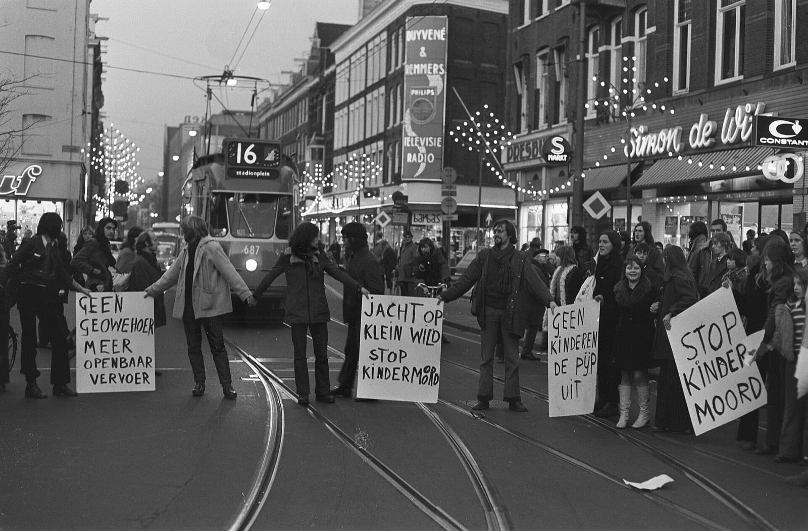
Photo: Rob Mieremet, Anefo / Nationaal Archief, CC0

The pressure group that took the name organized nationally, occupied crash sites, closed streets so children could play in them, and staged die-ins. The 1973 oil embargo arrived to help.
The state did not lead this. The state was DRAGGED.
Rotterdam Is the Control Experiment
If you want a clean test of whether car-dominated urban form is chosen or imposed, the Netherlands hands you one.
Rotterdam’s center was destroyed in 1940 and rebuilt on the Van Traa plan as a functional modernist city. Same country, same decade, same culture as Amsterdam, but one city got a blank slate and professional planners filled it with car infrastructure while the other kept a street pattern laid down before anyone had seen an automobile.
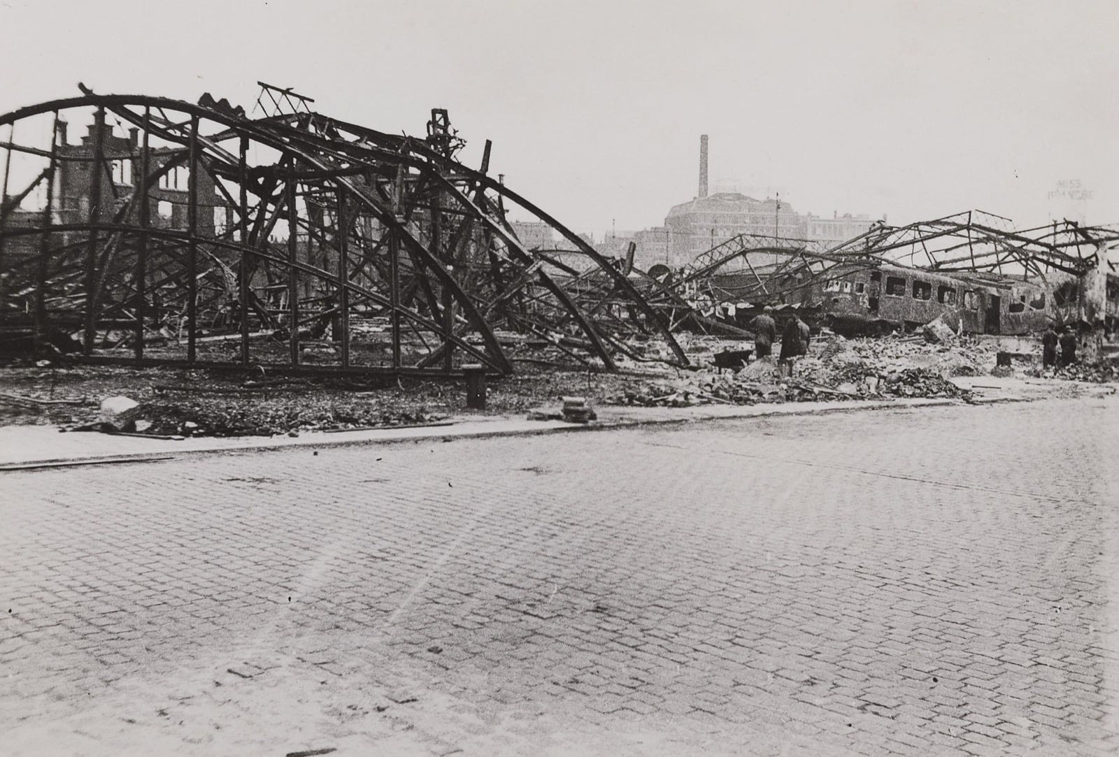
Photo: unknown photographer, Wikimedia Commons, public domain

Rotterdam’s arterials did not emerge from consumer preference. They were drawn.
Then, on 11 March 1970, residents of the Oude Westen organized. The Aktiegroep worked with two architects, Pietro Hammel and Nico Witstok, on a plan to rehabilitate the neighborhood rather than demolish it. Actions ran nearly weekly. Residents described official policy as kaalslag, clear-cutting, and deportatie.
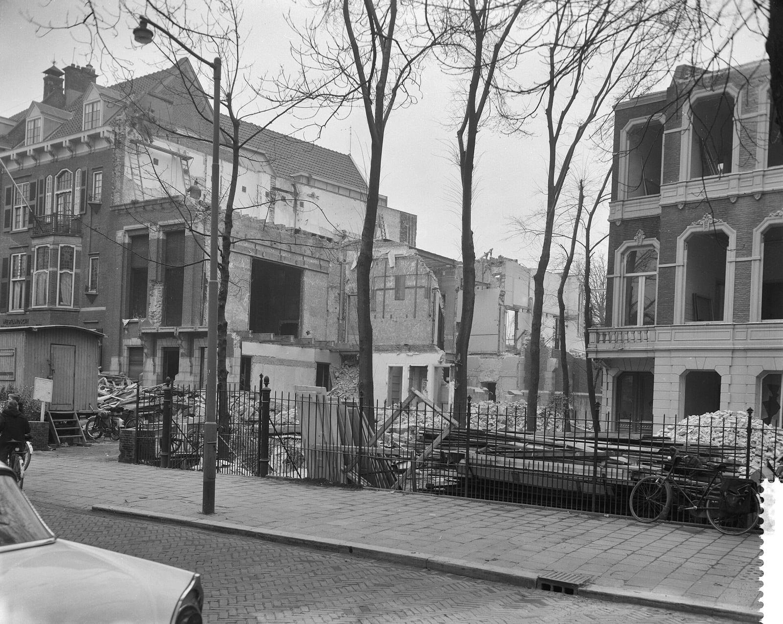
Photo: Herbert Behrens, Anefo / Nationaal Archief, CC0

Officials responded with astonishment and anger, and then gave way. By the middle of the decade the entire policy had inverted: Small scale, priority to living, and minimal disruption of the existing social and physical fabric, in place of city-forming, car access, and large-scale redevelopment.
Their two slogans are the reason this matters to anyone who cares about self-government:
Bouwen voor de buurt. Build for the neighborhood.
Baas in eigen buurt. Boss in your own neighborhood.
That is subsidiarity, in four words, shouted by people with no theory of it.
Except they did have one. It was seven centuries old and had long since stopped feeling like a theory.
The water boards came first. From the 13th century, communities in the Low Countries organized to build and hold the dikes, the oldest of them taking its commission in 1248. They levied their own taxes, conscripted their own labor, and settled their own disputes, all of it outside the feudal hierarchy, because a lord three provinces away could not tell you which stretch of dike was about to give. Every landowner had a stake, so every landowner paid and voted.
Twenty-one of them still operate. They are the oldest continuously functioning democratic institutions in the country, older than the Dutch state.
The land followed the water. Across western Europe a nobility of roughly 2 percent of the population held 40 to 50 percent of the land. In Holland and Friesland the rural population was largely free, the estates were small and scattered, and the aristocracy never captured local government the way it did everywhere else. Which follows, if you consider who made the land. The people standing on it pulled it out of the water.
So the Oude Westen in 1970 was repeating a principle that had been running, without anyone’s permission, since before the Netherlands existed.
An honest note, because the tidy version of this story is false. The renewal that followed ran on substantial state subsidy. The city bought whole districts, writing to homeowners with offers of 25 percent above assessed value, and owners who would not sell were, in the source’s own words, “effectively harassed out by the city’s relentless enforcement of tenants’ demands.”
This was not a libertarian fable. It was a fight about which level of government holds the pen, not about whether government holds it. That is still the argument I want to make, just in its true form rather than its flattering one.
Tokyo Proves It Isn’t a European Sensibility
The easiest way to dismiss all of this is to call it a European sensibility. Old cities, short distances, a temperament Americans do not have and would not want. Japan makes that reading hard to sustain.
Tokyo runs almost no street parking, and what exists is usually capped at an hour. Parking on the street overnight is forbidden outright. And in Japanese cities, before you can register a car at all, you have to produce a certificate proving you hold an off-street space for it within two kilometers of your address. It is called the *shako shomeisho.
Set that against an American parking minimum and the inversion is clean. The American rule puts the obligation on every building: A shop, a house, an office, each one required to carry stalls it may never fill. The Japanese rule puts the obligation on the person buying the car.
One rule surrounds every destination with asphalt nobody asked for. The other lets the street stay narrow, because nothing has to be stored on it.
Narrow streets are slow streets, and slow streets can mix traffic instead of separating it. Which is why Japanese cities carry an enormous volume of cycling while building very little dedicated cycling infrastructure, a fact that should trouble anyone who assumes the Dutch outcome requires the Dutch budget.
Three countries, three rules, three built environments.
The variable is not culture.
Why the American Highway Revolt Won Battles and Lost the War
Highway revolts were not a Dutch peculiarity. They happened across the developed world in the 1960s and 1970s. Americans fought the same fight. Jane Jacobs beat Robert Moses on the Lower Manhattan Expressway.
And then the pattern continued anyway, for another fifty years.
The reason is structural, not cultural. In the United States, funding is federal, design standards are set at the state level, and land use is decided municipally. No single body owns the outcome, which means no single body can be removed over it. A neighborhood that wins locally still faces a state manual it cannot amend and a federal formula it cannot see.
Dutch municipalities held funding, design, and land use close enough together that a well-organized neighborhood could actually win, and then keep what it won.
Diffuse the authority and you extinguish accountability. That is the general lesson, and streets happen to be where it is easiest to see, because you can stand on the result.
Cape Town, Where the Distance Was the Policy
We’ve spent a lot of time in and around Cape Town, which means I’ve seen the clearest example of this in one direction and the clearest in the other.
Cape Town is the purest case anywhere of space engineered as an instrument of state power. Under the Group Areas Act, highways, railway lines, and open buffer strips were used deliberately to separate populations, with the strips specified at a minimum width of 30 meters. Central land went to whites, the periphery to black Africans, the gaps to coloureds. District Six was rezoned white in 1966 and at least 60,000 people were moved to the Cape Flats.
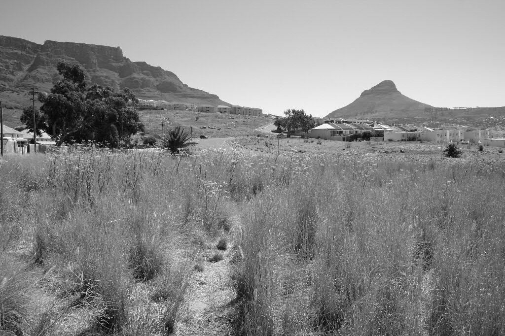
Photo: Derek Keats, Wikimedia Commons, CC BY 2.0

Townships were sited far from the work, and the distance was the policy, not an accident of growth.
Whatever else one wants to argue about that period, this part is not contested and does not require any theory of ethnicity to describe. It requires only the observation that a state with sufficient authority over land use can build a social order in concrete and then leave it there for the grandchildren of everyone involved.
That is the thing worth taking from all of this. The distance between a street and a road is not a matter of taste, or environmentalism, or whether you happen to like driving.
I like driving. The Dutch build superb motorways and own plenty of cars. They simply refused to confuse the two functions.
The question was never cars.
The question is who holds the pen.